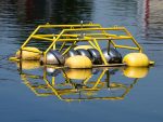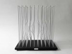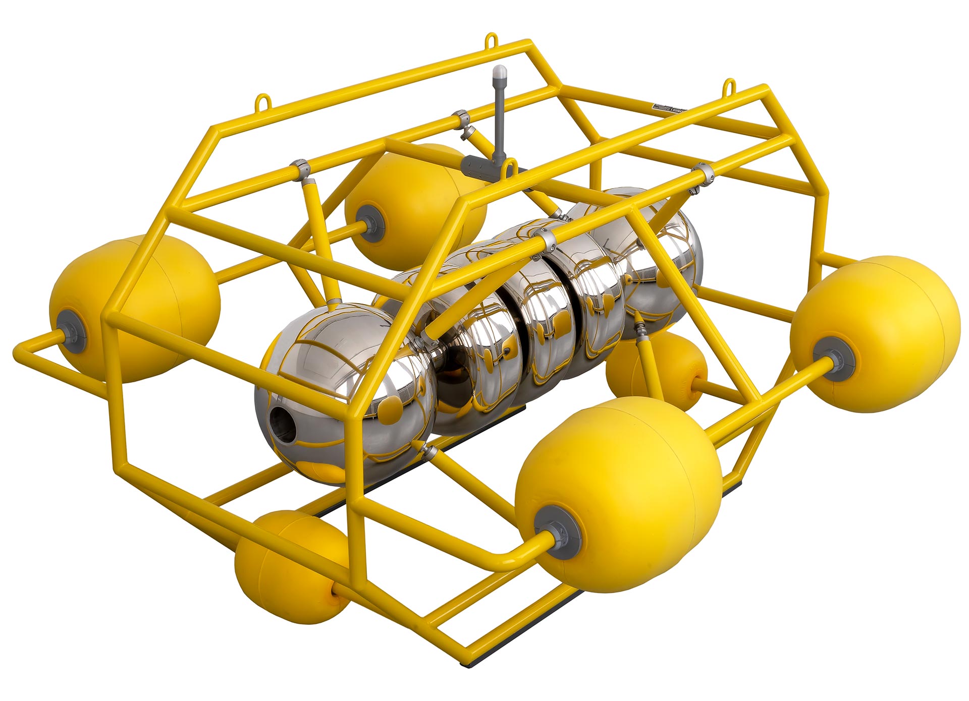
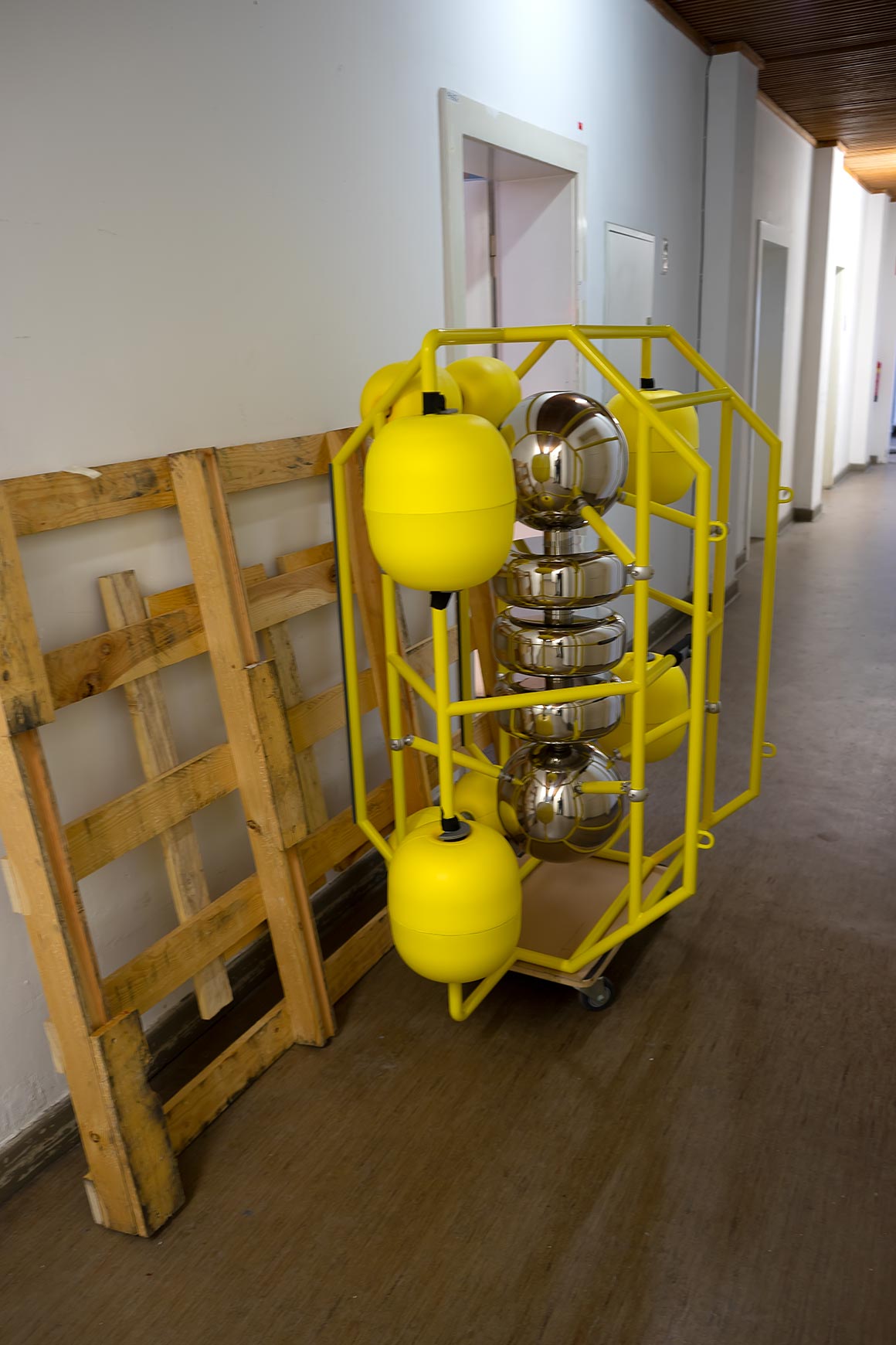
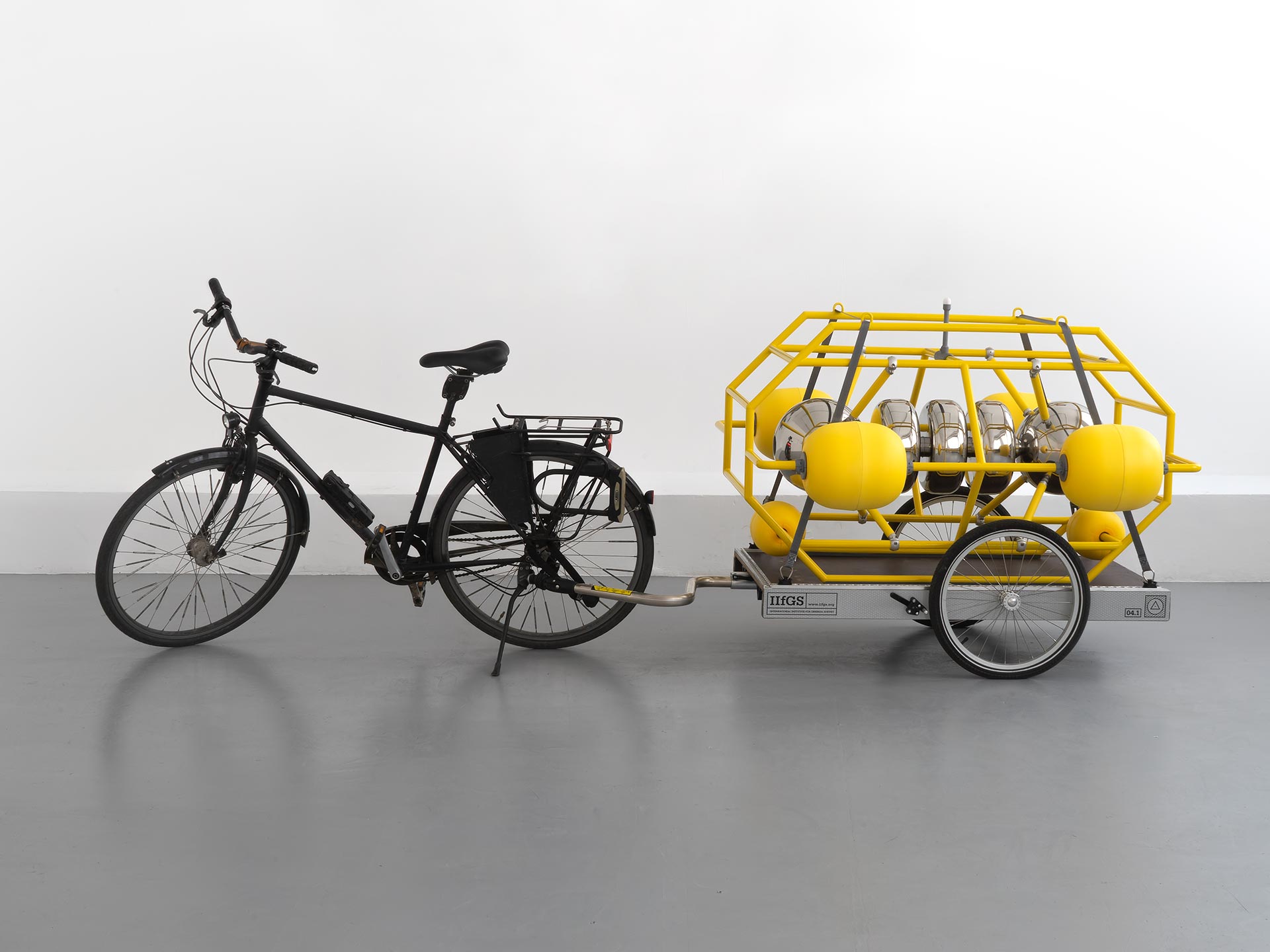
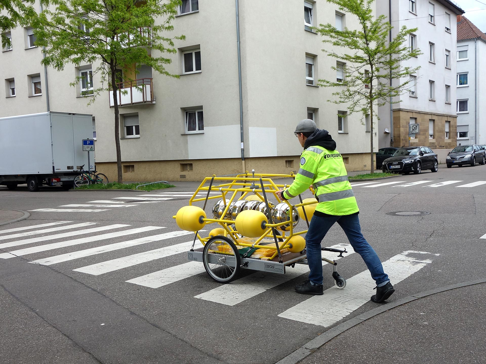
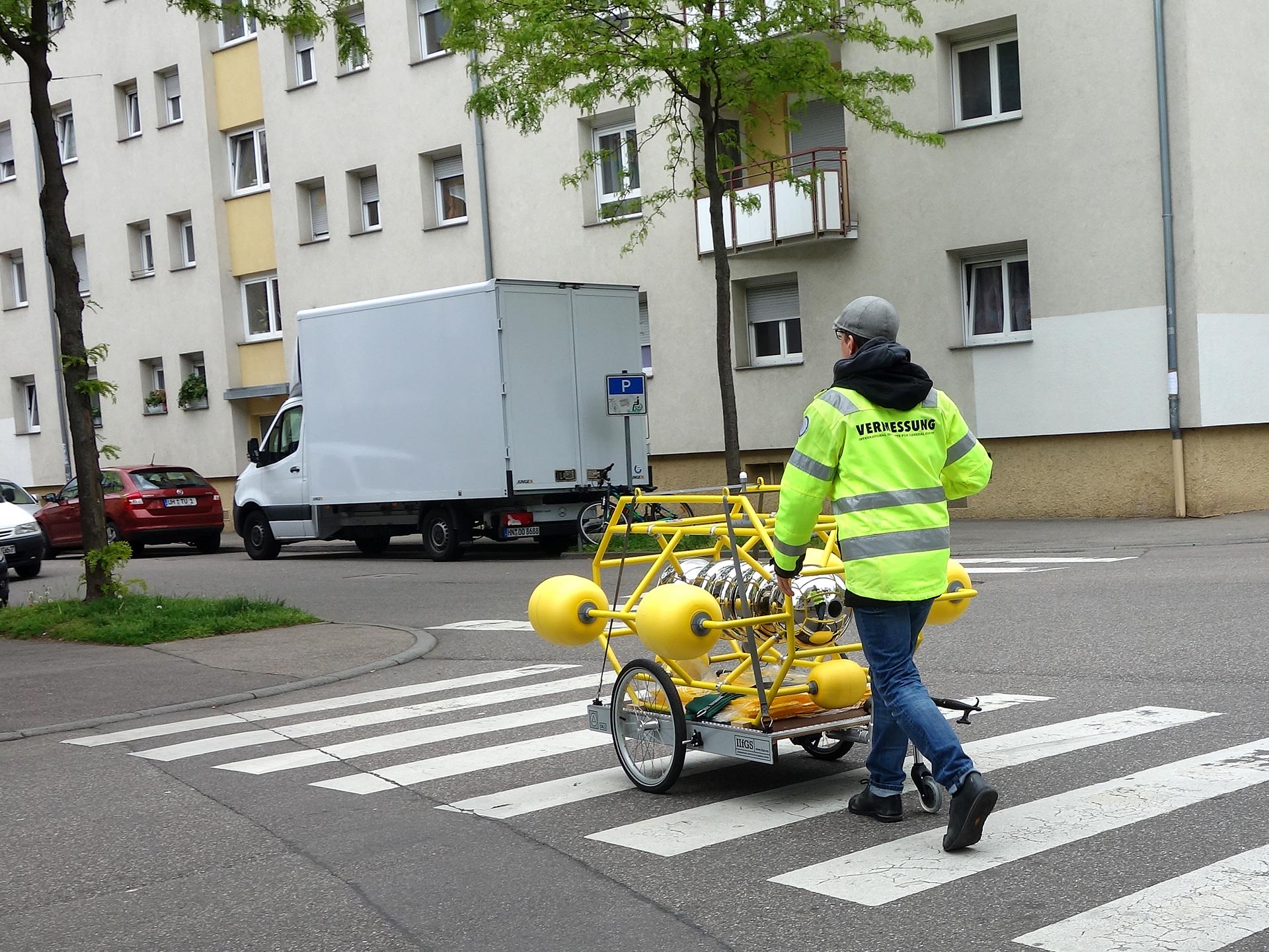
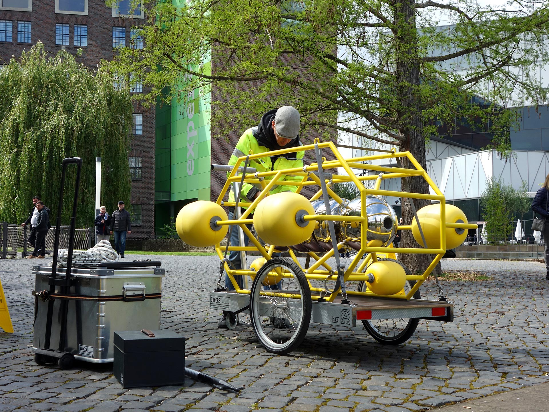
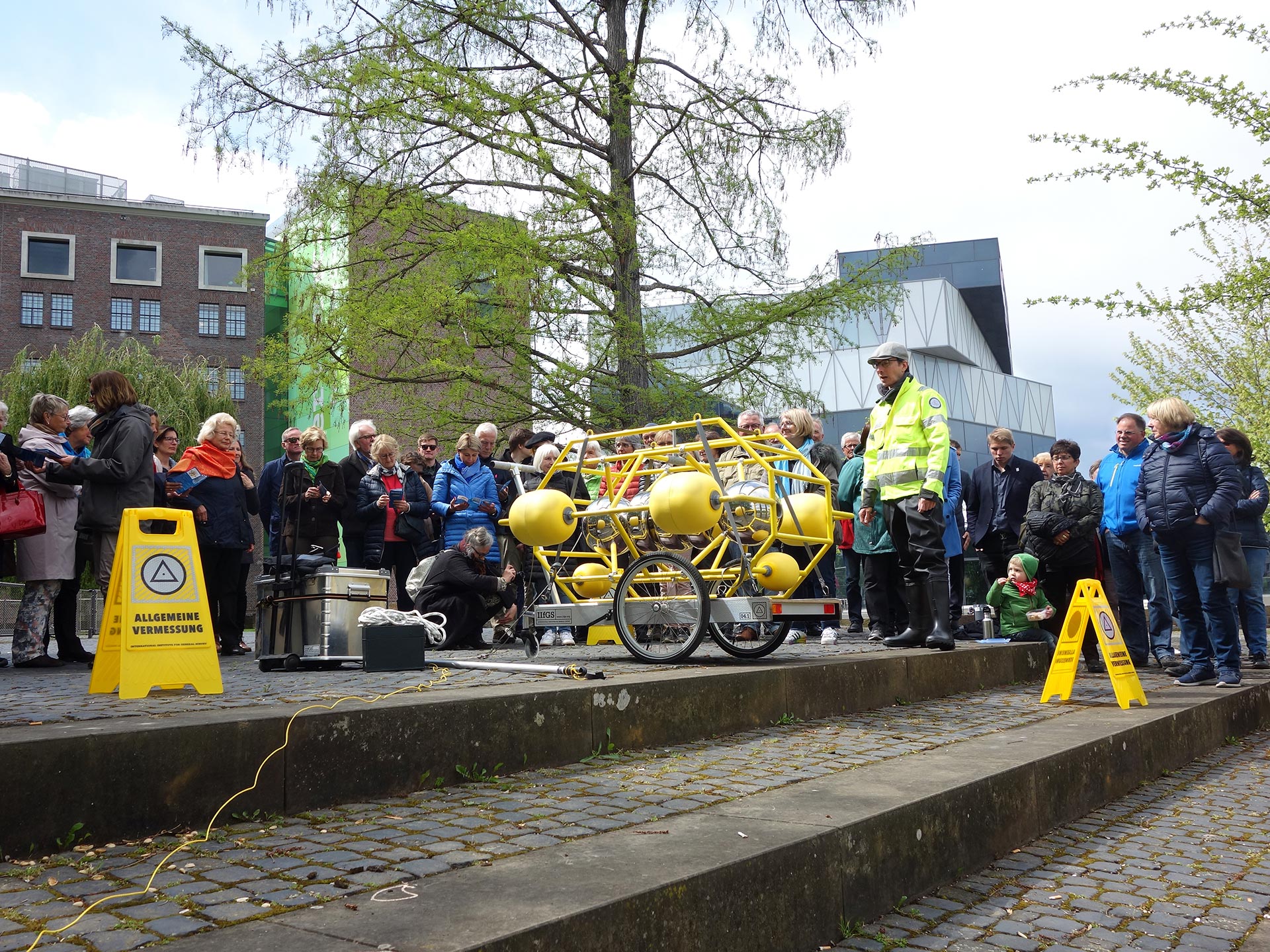
2019, Measuring buoy with transport trolley (hand trolley/bicycle trailer)
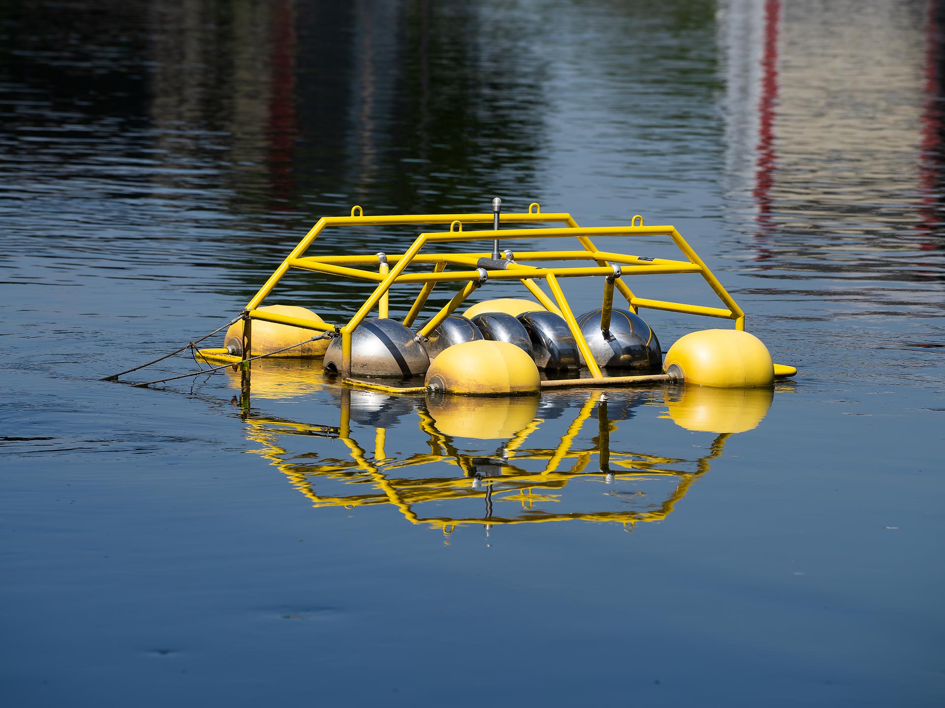
Material measuring buoy: powder-coated steel, polished stainless steel, aluminium, various plastics (EVA, PVC, PLA), electronics
Height: 87 cm Draft: 40 cm
Width: 133 cm Weight: 55 kg
Length: 132 cm
METRIOS 1 was developed by Valentin Beinroth in cooperation with the International Institute for General Survey (IIfGS) in Frankfurt am Main.
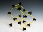
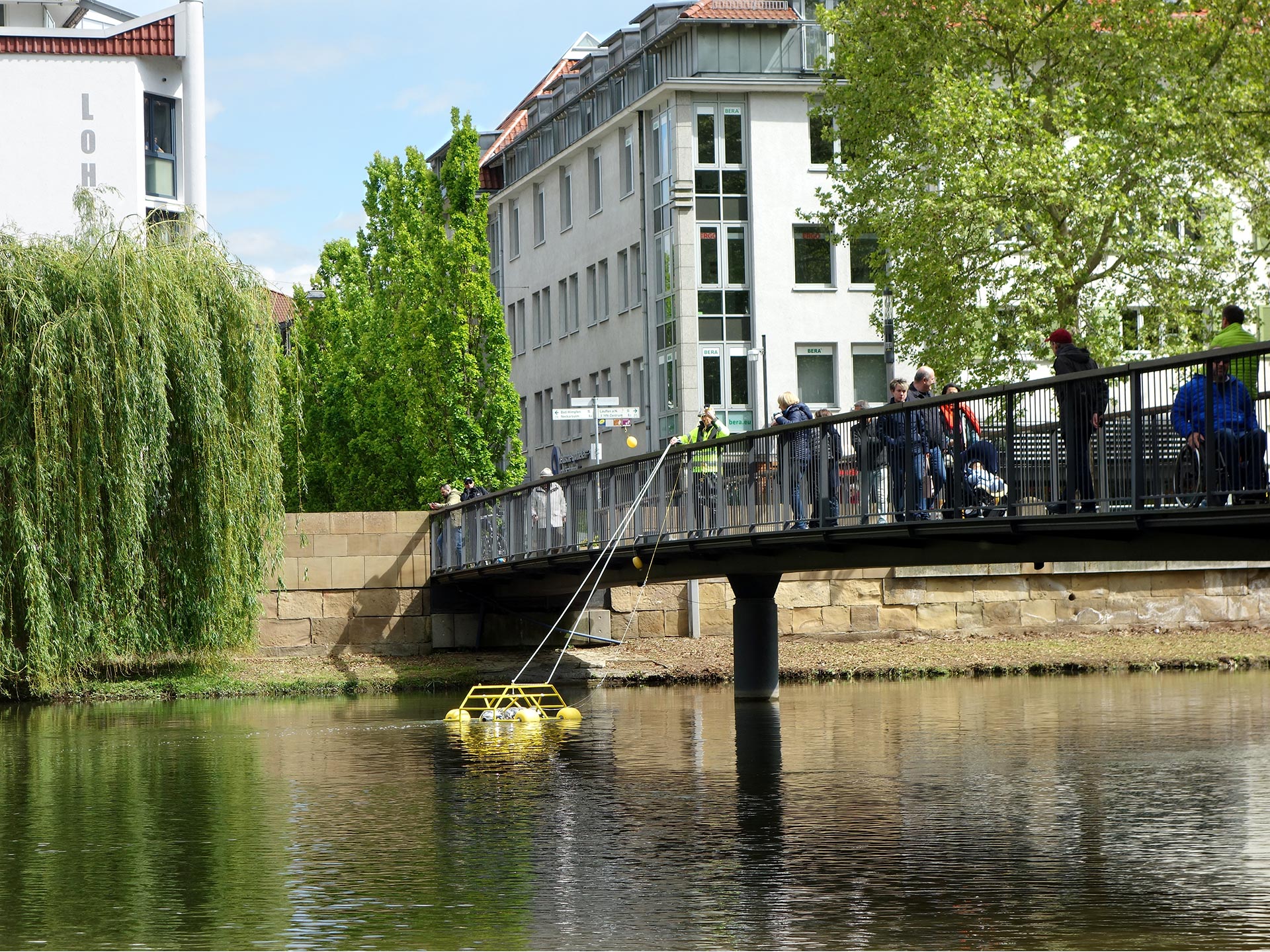
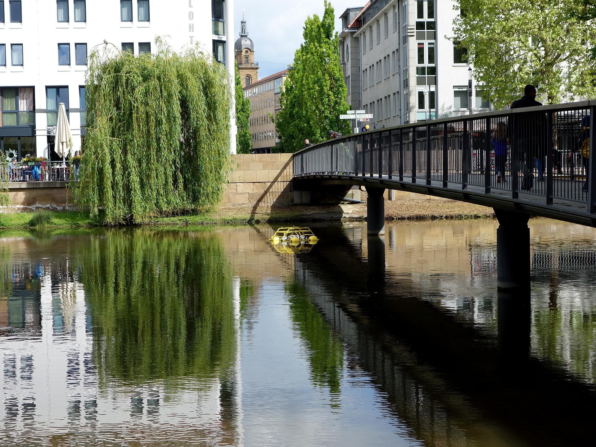
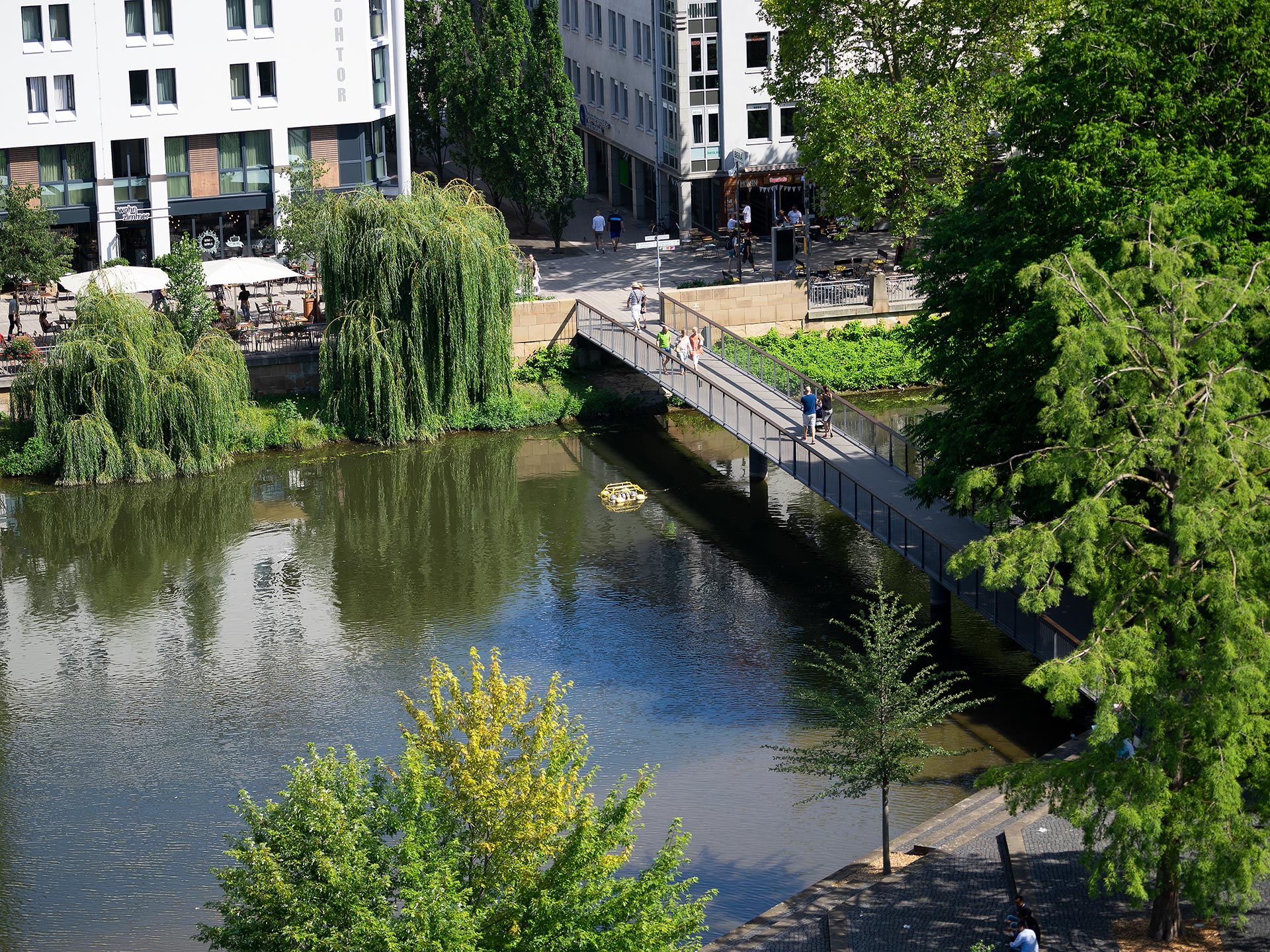
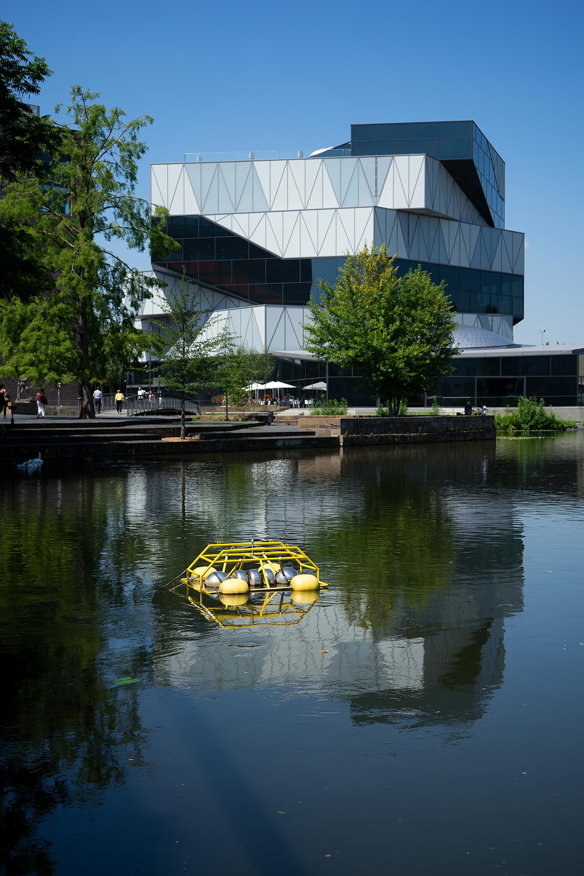
The 55 kg measuring buoy belongs to the group of ASVs (Autonomous Surface Vehicles) and is used here moored at the Adolf-Cluss-Bridge in Heilbronn. It can also be used as a towing or drift buoy. ASVs carry out their surveying tasks without user intervention. As they often require little or no human assistance during their long periods of use, these small instruments are particularly suitable for data capture in remote locations or difficult survey areas such as here in Heilbronn city centre.
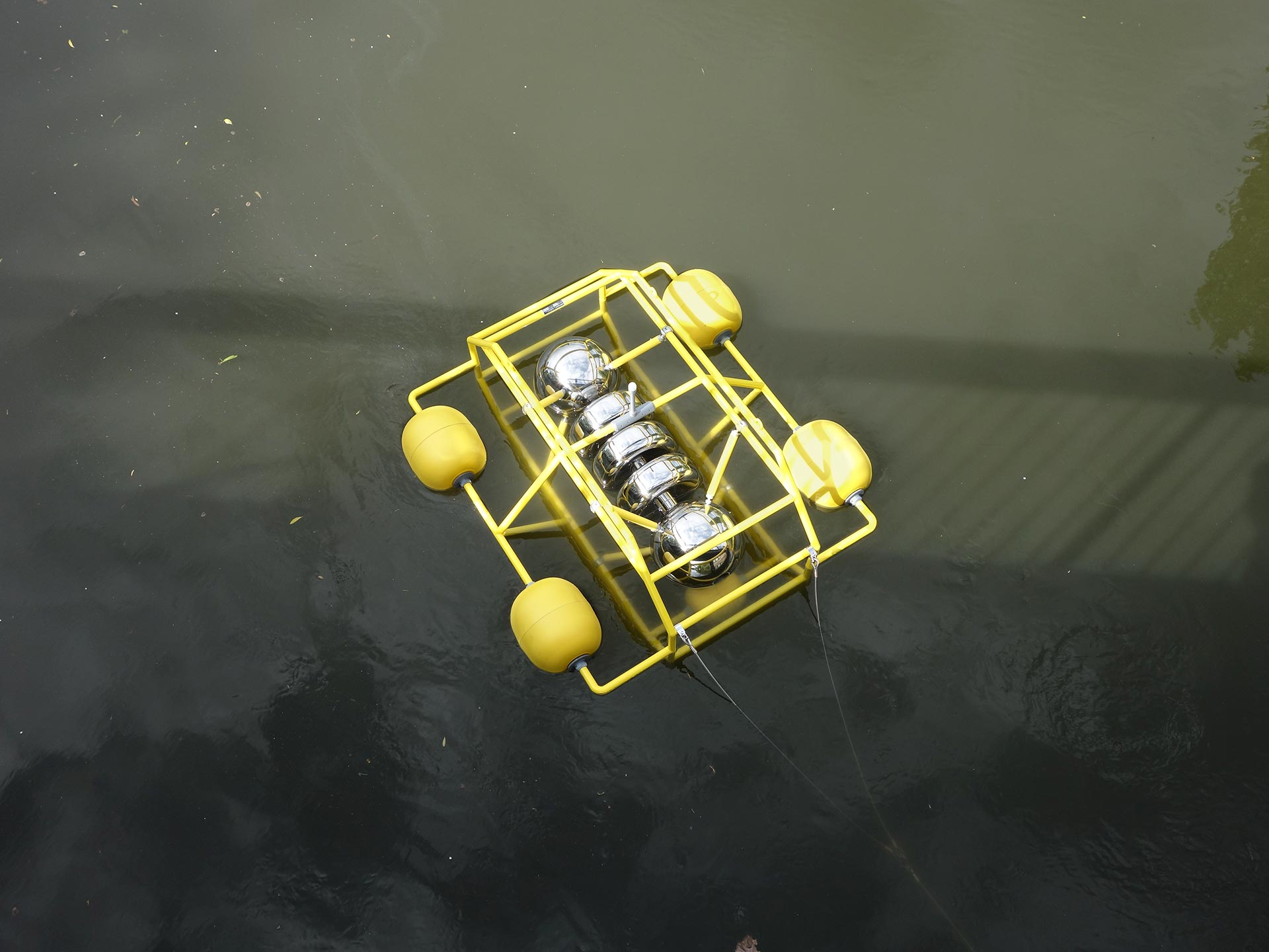
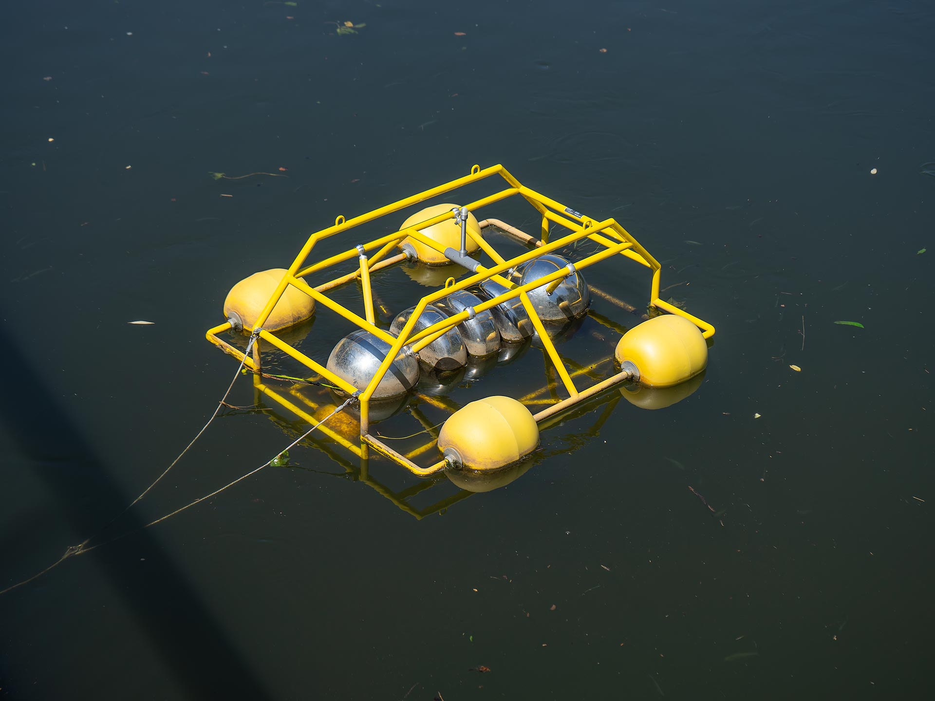
METRIOS 1 carries out a quantification of the environment using the methods of General Survey.
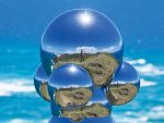
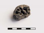
The measuring buoy carries a measuring probe with REPODA sensor technology (Reverse Photo Optical Distortion Array) and measures the environmental parameters via reflection. The acronym METRIOS stands for “Modular Explorer Taking REPODA Instruments to Observe Surroundings”.
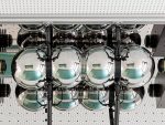
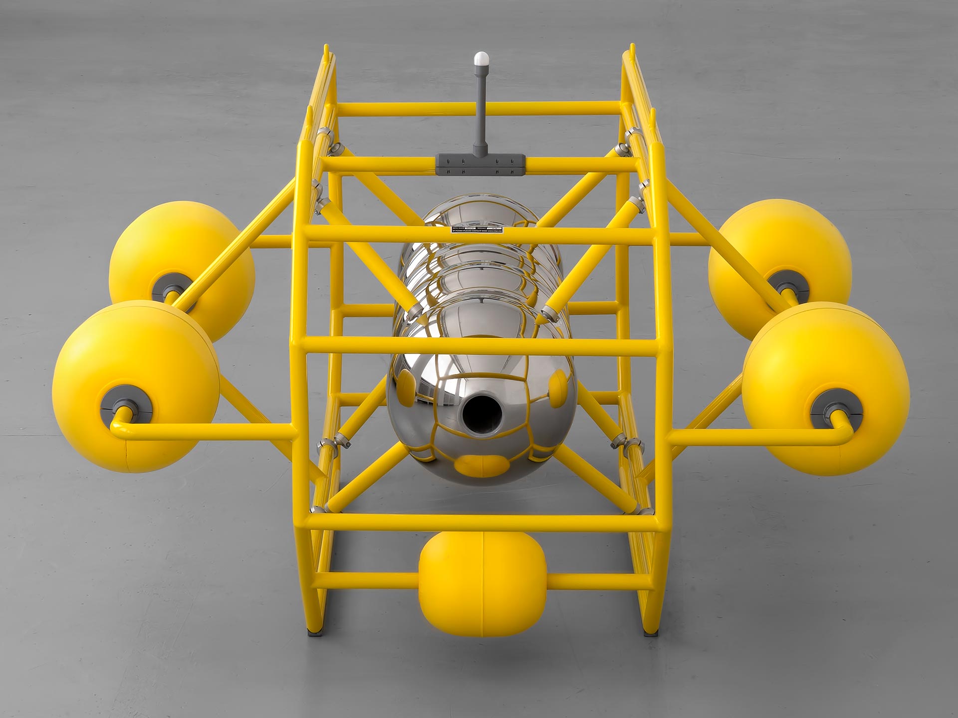
All measurements are made inside the highly reflective probe located in the middle of the buoy cage. Water flows through a central 1.25 m long measuring tube. The sensor system of the measurement module quantifies the distorted reflections of the wave signals that occur above and below the waterline. This is done by comparing the graduant of the system’s own specific distortion coefficient.
The shape of the probe plays an important role in this measurement procedure. By changing the measuring probes, METRIOS measuring buoys can repeat the measurements with a different system and further conclusions can be drawn from the comparison of the values.
The long-term data sets will be evaluated after the end of the measurement period at the end of summer 2019.
Modular ASV (Autonomous Surface Vehicle)
• Optimized design for rough ocean environment
• Easy deploy
• Easy retrieval
• Long service life
• High payload potential
• Can be used anchored, as a tow buoy or drift buoy
Applications:
• REPODA probe operation
• Surface to underwater communications node
• General aquatile data acquisition
• Passive and active General Survey

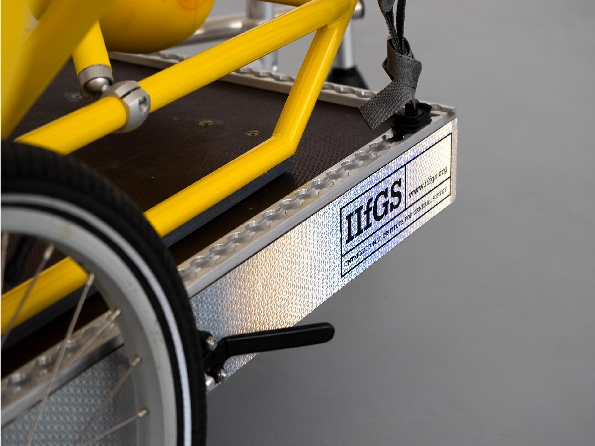

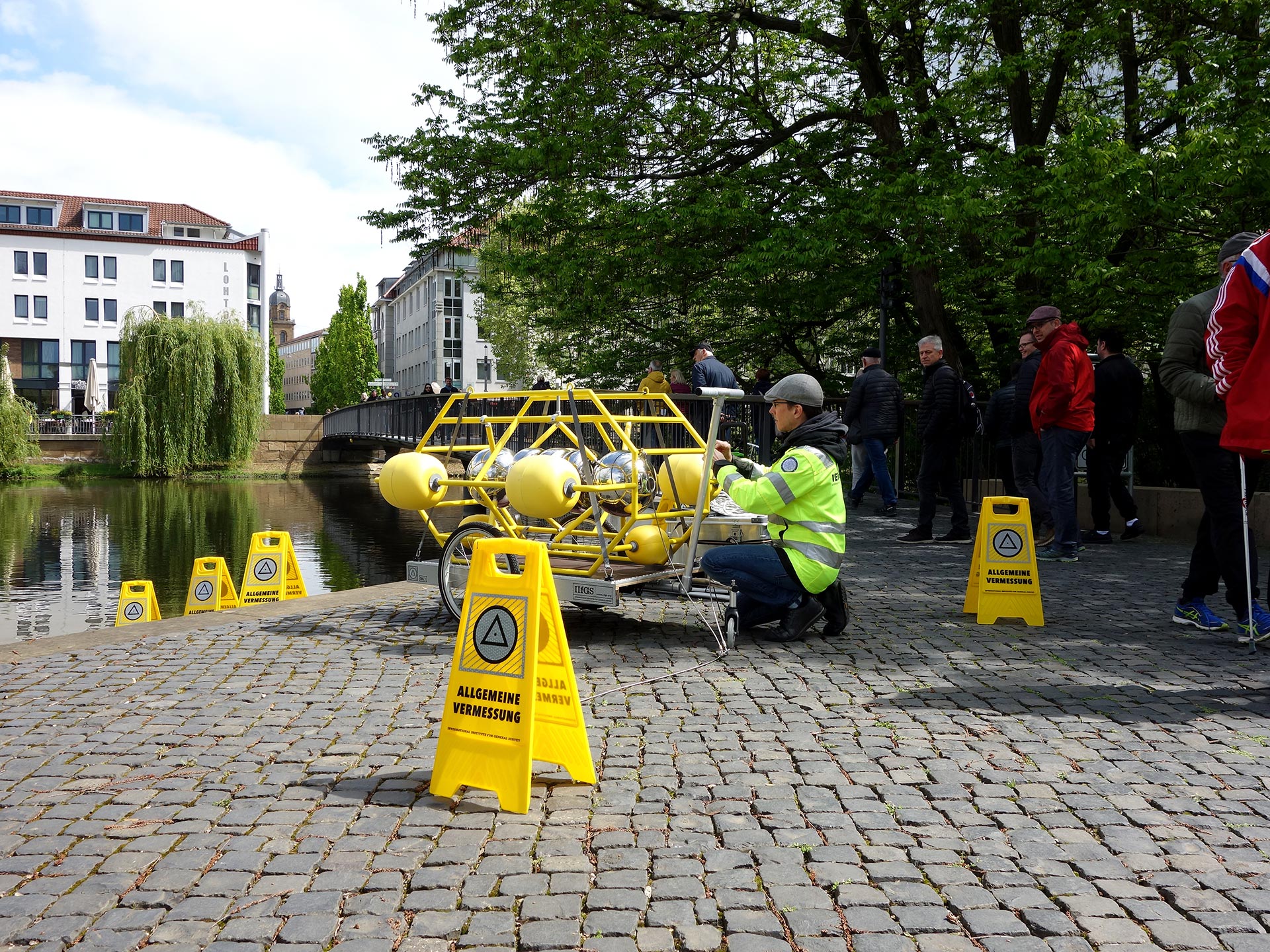


The IIfGS (International Institute for General Survey) www.iifgs.org
Every year, the International Institute for General survey carries out measurements at various measuring points, including land, coastal and estuarine sites ,as well as rivers in urban environments. It uses dozens of temporary instruments.
The IIfGS Department of General Aquatile survey investigates water locations worldwide and makes the results available to the public.
In the GS2 programme of the IIfGS, this department, supported by the IIfGS Quantum Metrology Division, develops surveying tools and technologies to collect long-term data sets of General Survey in a global environment.
In order to be able to create models that are as accurate as possible, the IIfGS regularly has to resurvey various locations. The selection of the survey sites is based on the General Survey theories, survey analyses and time that has passed since the last survey. Given today’s advances in surveying and computer technology, these investigations significantly improve the accuracy of the models.
To collect the required data, IIfGS scientists typically deploy measuring buoys with measuring heads (including PODAs or REPODAs) to measure the waterline at different locations for a period of one to twelve months. From the observations of the instruments, model forecasts for these locations are made.
IIFGS Measuring Buoys
Measuring buoys can be equipped with a variety of sensors to monitor various environmental conditions. This information provides a more complete picture of what is happening in the instrument coverage area, as well as trends that scientists might not otherwise be able to see from satellites, aircraft or large research vessels.
While there are many measuring buoy designs that use different techniques to move through the water, all measuring buoys share the ability to travel long distances over long periods of time without maintenance. Unmanned measuring buoys study the environment in places where it is impractical or even impossible to send people. The sensors of the METRIOS measuring buoy provide high-resolution physical General Survey data at a relatively low cost.
These characteristics and the advances in sensor technology make measuring buoys increasingly important tools for General Survey.